Texas Homeowner Pays $3000 to Trim Trees After Insurance Warning
A Texas homeowner paid $3000 to trim trees, insurer used aerial images to assess risk.
'%3E%3Crect%20width%3D'96'%20height%3D'96'%20fill%3D'%23B3261E'%2F%3E%3Ccircle%20cx%3D'30'%20cy%3D'24'%20r%3D'44'%20fill%3D'%23fff'%20opacity%3D'.12'%2F%3E%3Ccircle%20cx%3D'60'%20cy%3D'74'%20r%3D'40'%20fill%3D'%23000'%20opacity%3D'.10'%2F%3E%3C%2Fg%3E%3Cg%20fill%3D'%23fff'%3E%3Crect%20x%3D'29'%20y%3D'49'%20width%3D'8'%20height%3D'19'%20rx%3D'1'%2F%3E%3Crect%20x%3D'39'%20y%3D'40'%20width%3D'9'%20height%3D'28'%20rx%3D'1'%2F%3E%3Crect%20x%3D'50'%20y%3D'45'%20width%3D'8'%20height%3D'23'%20rx%3D'1'%2F%3E%3Crect%20x%3D'60'%20y%3D'53'%20width%3D'7'%20height%3D'15'%20rx%3D'1'%2F%3E%3Crect%20x%3D'41'%20y%3D'34'%20width%3D'5'%20height%3D'6'%2F%3E%3C%2Fg%3E%3C%2Fsvg%3E)
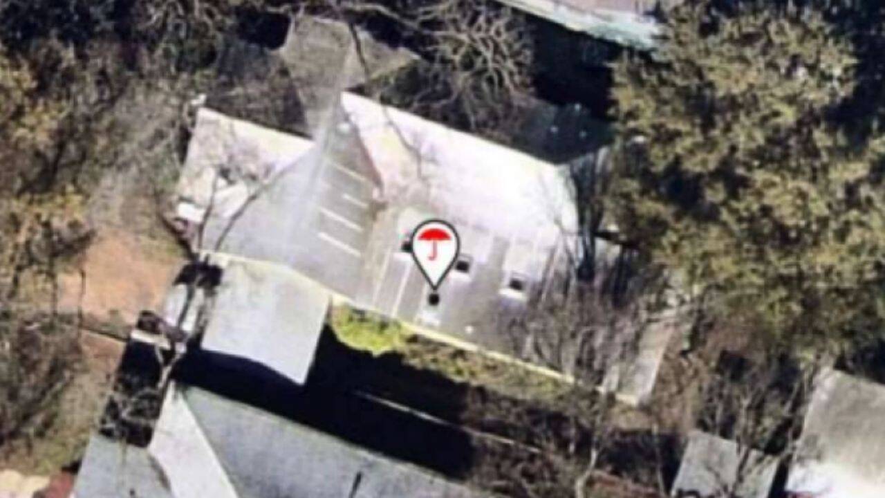
A homeowner in Austin, Texas, was recently forced to pay $3000 to trim trees on their property after their insurance company warned them that the trees posed a risk to their home. This incident highlights a growing trend in the US insurance industry, where companies are using aerial images of properties to assess risks and decide whether to renew policies.
The use of aerial images, which can be taken by satellites, aircraft, or third-party providers, allows insurers to quickly and efficiently assess the condition of a property. Some insurance companies are even using artificial intelligence (AI) to analyse the images and identify potential risks, such as damaged roofs or overhanging trees.
While insurers argue that this technology is faster and more efficient than traditional methods of assessment, consumer advocates are warning that outdated or inaccurate images can lead to wrong decisions. If an image is outdated, it may not reflect recent changes to the property, such as repairs or maintenance. Similarly, if an image is inaccurate, it may misrepresent the condition of the property, leading to incorrect assessments of risk.
In the case of the Austin homeowner, the insurance company used aerial images to identify the trees as a potential risk. The homeowner was then given an ultimatum: trim the trees or risk having their policy cancelled. The homeowner chose to pay the $3000 to trim the trees, rather than risk losing their insurance coverage.
This incident raises important questions about the use of aerial images in the insurance industry. While the technology can be useful for assessing risk, it is not foolproof. Consumer advocates argue that insurers should be careful to ensure that the images they use are up-to-date and accurate, and that they do not rely solely on technology to make decisions about policyholders.
The use of aerial images is becoming increasingly common in the US insurance industry, with many companies investing heavily in the technology. However, as the incident in Austin highlights, there are potential pitfalls to this approach. Policyholders need to be aware of the risks and take steps to ensure that their properties are accurately represented in aerial images.
In recent years, there has been a significant increase in the use of technology in the insurance industry. Insurers are using data analytics, AI, and other technologies to assess risk, process claims, and provide customer service. While these technologies can be useful, they also raise important questions about privacy, accuracy, and fairness.
As the insurance industry continues to evolve, it is likely that the use of aerial images will become even more widespread. However, it is important for insurers to ensure that they are using this technology in a way that is fair, accurate, and transparent. Policyholders have a right to know how their properties are being assessed, and to challenge any decisions that are made on the basis of outdated or inaccurate information.
In conclusion, the incident in Austin highlights the potential risks and benefits of using aerial images in the insurance industry. While the technology can be useful for assessing risk, it is not foolproof, and insurers need to be careful to ensure that they are using it in a way that is fair, accurate, and transparent.
Frequently asked questions
Why are insurance companies using aerial images of properties?
Insurance companies are using aerial images to assess risks and decide whether to renew policies. They use satellite, aircraft and third-party imagery, with some companies using AI to analyse roofs and identify possible damage.
What are the potential pitfalls of using aerial images in the insurance industry?
The potential pitfalls of using aerial images include outdated or inaccurate images leading to wrong decisions, and policyholders being forced to take unnecessary actions to mitigate perceived risks.