India's Air Force to Deploy High-Altitude Drones for Extended Surveillance
HAPS technology will enable persistent military reconnaissance over vast areas for weeks continuously.
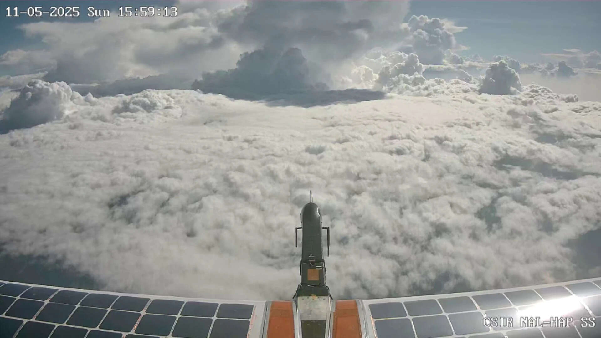
India's defence forces are preparing to integrate High Altitude Pseudo Satellites (HAPS) into their surveillance arsenal, marking a significant advancement in the nation's reconnaissance capabilities. These cutting-edge aerial platforms will operate at altitudes of 20 kilometres, providing continuous intelligence gathering over extensive territories for extended periods.
The domestic development initiative, spearheaded by the Defence Research and Development Organisation (DRDO) and the National Aerospace Laboratories (NAL), has already achieved encouraging results through successful test flights. These solar-powered aircraft represent a hybrid approach to surveillance, positioning themselves between conventional aircraft and orbiting satellites in terms of operational advantages.
The introduction of HAPS technology addresses a critical gap in India's intelligence, surveillance, and reconnaissance capabilities. Unlike traditional satellites that require significant investment and have limited flexibility, and unlike manned aircraft that have restricted endurance, these platforms offer a cost-effective middle ground with remarkable persistence. The extended operational duration—weeks at a time—enables sustained monitoring of target areas without constant repositioning.
For India's military infrastructure, this development carries substantial implications for border security and coastal surveillance. The persistent presence of these platforms over sensitive regions would enhance threat detection and response capabilities, particularly relevant given India's geographic challenges and maritime interests. The indigenous development also reduces dependence on foreign surveillance systems and strengthens national self-reliance in defence technology.
Experts anticipate that once fully operationalised, HAPS technology will complement existing satellite networks and airborne platforms, creating a more comprehensive surveillance ecosystem. The solar-powered design ensures sustainability for long-duration missions, while the 20-kilometre altitude provides coverage advantages over conventional aerial assets while remaining below satellite orbital paths.
Source: Times of India